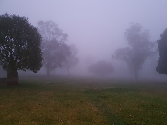
The month of May 2024, has been dominated by blocking highs, which has kept relatively consistent weather across the country for quite some time now. But now with temperatures dropping into winter, these highs are bringing near perfect conditions for thick fog to form over the coming days.
Indeed, many people in east and southeast Australia would have woken up to thick fog shrouding their backyards this morning, as visibility dropped below 100m in numerous locations across southern and eastern NSW, Vic including:
- Kilmore Gap, Vic – less than 50m
- Scone, NSW – less than 50m
- Moss Vale, NSW – 50m
- Lake Eildon, Vic – 100m
- Lismore Ap, NSW – 100m
- Richmond, NSW – 100m
Even Mount Gambier in southeastern SA saw visibility drop to just 200m, while Oakey Ap, in QLD’s Darling Downs region, dropped to just 300m of visibility this morning.
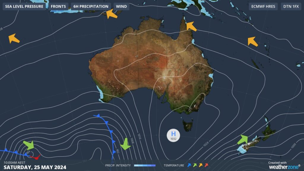
You can see in this morning’s synoptic image, a high extending a ridge southeastern Australia, a common sight on the synoptic images of the last few weeks. In the coming days, the high itself will move north, setting up camp over the country’s southeast tomorrow.
During this high’s camping trip, a run of still nights and crystal-clear skies will bring an abundance of foggy morning, and evenings well into next week. Who knows, there may even be another spooky spectre somewhere, as our own meteorologist James Rout observed a few weeks ago west of Sydney. You can read about his encounter here.
Thick fog can become a hazard in some instances, particularly in the transport industry. It was only less than 2 weeks ago that Sydney ferries was forced to temporarily cancel all services as heavy fog rolled through the harbour, so some people may not be thrilled about the prospect of thick fog forming consistently over several days. Thick fog can also result in road weather alerts been issued by the BoM.
High pressure will sit over southeast Australia until Wednesday, when it packs up and drifts off the east coast, although a ridge may still extend over northern NSW providing one more foggy morning on Thursday. Conditions will then become less conducive to fog late in the week, as a trough and cold front move through eastern and southeast Australia, increasing overnight winds.